![](/images/other/stat-length.png)
![Randonnée Marche Les Ollières-sur-Eyrieux - Serré de Gruas - Photo](https://media.geolcdn.com/t/1900/400/08cf67dd-d65b-4d6b-a337-2ee393033a8e.jpg&format=pjpeg&maxdim=2)
Serré de Gruas
ajd26
Utilisateur
![Longueur](/images/other/stat-length.png)
Longueur
16,8 km
![Altitude max](https://static1.geolcdn.com/siteimages/upload/files/1508320355ic_sort_altitude_max_24dp.png)
Altitude max
816 m
![Dénivelé positif](https://static1.geolcdn.com/siteimages/upload/files/1508320355ic_sort_den_pos_24dp.png)
Dénivelé positif
788 m
![Km-Effort](/images/other/stat-length.png)
Km-Effort
27 km
![Altitude min](https://static1.geolcdn.com/siteimages/upload/files/1508320355ic_sort_altitude_min_24dp.png)
Altitude min
175 m
![Dénivelé négatif](https://static1.geolcdn.com/siteimages/upload/files/1508320355ic_sort_den_neg_24dp.png)
Dénivelé négatif
792 m
![Boucle](https://static1.geolcdn.com/siteimages/upload/files/16400158638029165_repeat_loop_refresh_sync_direction_icon.png)
Boucle
Oui
Date de création :
2022-03-27 09:30:47.0
Dernière modification :
2022-03-28 07:02:37.228
![Marche](https://static1.geolcdn.com/sitytour/trail-icons/101.png)
4h51
Difficulté : Facile
![Scannez ce code QR pour ouvrir la randonnée dans l'application SityTrail](https://capi.geolives.com/qq0zvz2zws4bq2lad0pu/sitytour/trails/3183020/qr.png?size=200)
Application GPS de randonnée GRATUITE
À propos
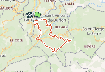
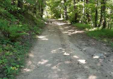
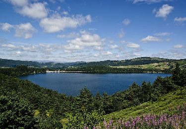
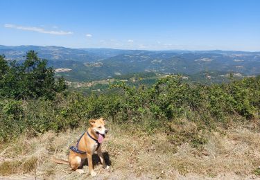
Randonnée Marche de 16,8 km à découvrir à Auvergne-Rhône-Alpes, Ardèche, Les Ollières-sur-Eyrieux. Cette randonnée est proposée par ajd26.
Description
depart des Ollieres (cimetiere)
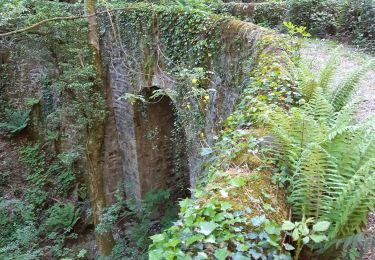
passer par le chateau de Bavas
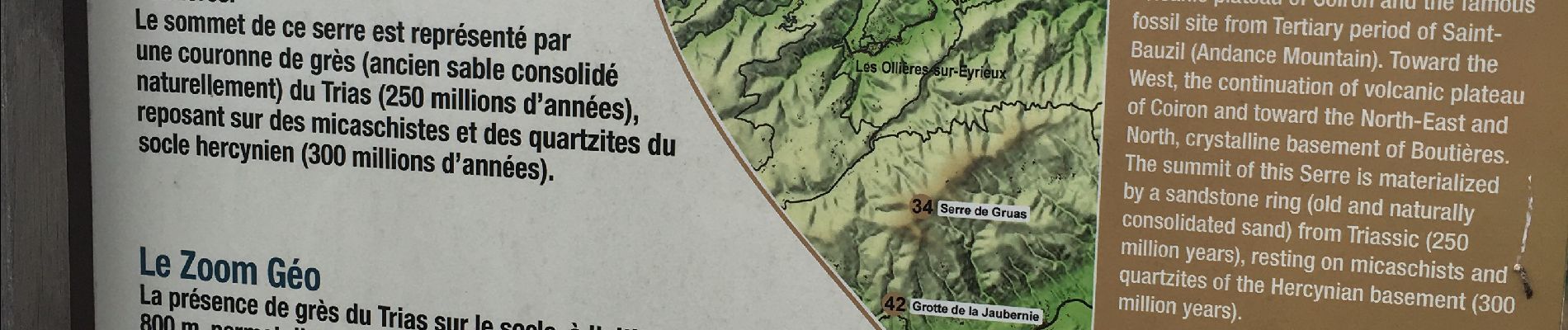
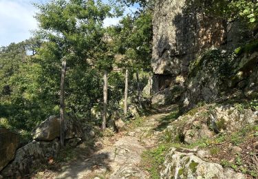
trés beaux panoramas nord et sud à partir des croix de Gruas
retour agreable
en faire plutot à la période où il n'y a pas de feuille
Localisation
Pays :
France
Région :
Auvergne-Rhône-Alpes
Département/Province :
Ardèche
Commune :
Les Ollières-sur-Eyrieux
Localité :
Unknown
Départ:(Dec)
Départ:(UTM)
627766 ; 4962114 (31T) N.
Commentaires
Randonnées à proximité
![Randonnée Marche Saint-Michel-de-Chabrillanoux - 07 st Michel de chabrillanoux 19.05.24 - Photo](https://media.geolcdn.com/t/375/260/9f01ef04-ea67-4f25-9a7e-6220ab4ae4e0.jpg&format=jpg&maxdim=2)
![Marche Marche](https://static1.geolcdn.com/sitytour/trail-icons/101.png)
07 st Michel de chabrillanoux 19.05.24
Marche
Moyen
Saint-Michel-de-Chabrillanoux,
Auvergne-Rhône-Alpes,
Ardèche,
France
![](/images/other/stat-length.png)
23 km | 35 km-effort
6h 45min
![](https://static1.geolcdn.com/siteimages/upload/files/16400158638029165_repeat_loop_refresh_sync_direction_icon.png)
Oui
![Randonnée Marche Pranles - 07 chirouze prandes - Photo](https://media.geolcdn.com/t/375/260/410f3c87-d596-4d9a-9969-d749769d3ba9.jpg&format=jpg&maxdim=2)
![Marche Marche](https://static1.geolcdn.com/sitytour/trail-icons/101.png)
07 chirouze prandes
Marche
Facile
Pranles,
Auvergne-Rhône-Alpes,
Ardèche,
France
![](/images/other/stat-length.png)
11,3 km | 17,6 km-effort
5h 12min
![](https://static1.geolcdn.com/siteimages/upload/files/16400158638029165_repeat_loop_refresh_sync_direction_icon.png)
Non
![Randonnée Marche Saint-Fortunat-sur-Eyrieux - 07 st fortunat dubieres st Vincent dufort - Photo](https://media.geolcdn.com/t/375/260/c34c03c4-9768-4a05-aafb-3fcd76453ebb.jpg&format=jpg&maxdim=2)
![Marche Marche](https://static1.geolcdn.com/sitytour/trail-icons/101.png)
07 st fortunat dubieres st Vincent dufort
Marche
Moyen
Saint-Fortunat-sur-Eyrieux,
Auvergne-Rhône-Alpes,
Ardèche,
France
![](/images/other/stat-length.png)
22 km | 33 km-effort
8h 41min
![](https://static1.geolcdn.com/siteimages/upload/files/16400158638029165_repeat_loop_refresh_sync_direction_icon.png)
Oui
![Randonnée Marche Les Ollières-sur-Eyrieux - 07 ollieres sur eyrieux Gruas - Photo](https://media.geolcdn.com/t/375/260/9ffda187-d312-43bf-86a6-ea773d0d4ffe.jpg&format=jpg&maxdim=2)
![Marche Marche](https://static1.geolcdn.com/sitytour/trail-icons/101.png)
07 ollieres sur eyrieux Gruas
Marche
Moyen
Les Ollières-sur-Eyrieux,
Auvergne-Rhône-Alpes,
Ardèche,
France
![](/images/other/stat-length.png)
16,5 km | 27 km-effort
7h 0min
![](https://static1.geolcdn.com/siteimages/upload/files/16400158638029165_repeat_loop_refresh_sync_direction_icon.png)
Oui
![Randonnée sport Pranles - Volcan des Chirouses - Azur - Photo](https://media.geolcdn.com/t/375/260/e60b1bfd-acf1-4756-a1be-a13c787b6ba0.jpg&format=jpg&maxdim=2)
Volcan des Chirouses - Azur
sport
Très facile
Pranles,
Auvergne-Rhône-Alpes,
Ardèche,
France
![](/images/other/stat-length.png)
14,4 km | 23 km-effort
Inconnu
![](https://static1.geolcdn.com/siteimages/upload/files/16400158638029165_repeat_loop_refresh_sync_direction_icon.png)
Oui
![Randonnée Vélo de route Saint-Fortunat-sur-Eyrieux - 07 st Fortunat st agreve vv - Photo](https://media.geolcdn.com/t/375/260/8f83dac9-764a-4d77-bc61-77b94ef715b6.jpg&format=jpg&maxdim=2)
![Vélo de route Vélo de route](https://static1.geolcdn.com/sitytour/trail-icons/201.png)
07 st Fortunat st agreve vv
Vélo de route
Moyen
(1)
Saint-Fortunat-sur-Eyrieux,
Auvergne-Rhône-Alpes,
Ardèche,
France
![](/images/other/stat-length.png)
59 km | 80 km-effort
6h 31min
![](https://static1.geolcdn.com/siteimages/upload/files/16400158638029165_repeat_loop_refresh_sync_direction_icon.png)
Non
![Randonnée Marche Saint-Sauveur-de-Montagut - photos de Saint-Sauveur Montagut - Photo](https://media.geolcdn.com/t/375/260/6f802caa-1bc0-44fb-aa94-5404077a498d.jpg&format=jpg&maxdim=2)
![Marche Marche](https://static1.geolcdn.com/sitytour/trail-icons/101.png)
photos de Saint-Sauveur Montagut
Marche
Difficile
Saint-Sauveur-de-Montagut,
Auvergne-Rhône-Alpes,
Ardèche,
France
![](/images/other/stat-length.png)
9 km | 15,6 km-effort
3h 54min
![](https://static1.geolcdn.com/siteimages/upload/files/16400158638029165_repeat_loop_refresh_sync_direction_icon.png)
Oui
![Randonnée Marche Pranles - Volcan de Chirouse 14 km. - Photo](https://media.geolcdn.com/t/375/260/aa0a374f-85d6-48cb-ab24-139c041e256a.jpeg&format=jpg&maxdim=2)
![Marche Marche](https://static1.geolcdn.com/sitytour/trail-icons/101.png)
Volcan de Chirouse 14 km.
Marche
Très difficile
Pranles,
Auvergne-Rhône-Alpes,
Ardèche,
France
![](/images/other/stat-length.png)
13,7 km | 22 km-effort
5h 3min
![](https://static1.geolcdn.com/siteimages/upload/files/16400158638029165_repeat_loop_refresh_sync_direction_icon.png)
Oui
![Randonnée Marche Saint-Vincent-de-Durfort - croix de grua - Photo](https://media.geolcdn.com/t/375/260/8757bbe0-ad12-42b9-b0e8-88a1f3bf1001.jpg&format=jpg&maxdim=2)
![Marche Marche](https://static1.geolcdn.com/sitytour/trail-icons/101.png)
croix de grua
Marche
Très difficile
Saint-Vincent-de-Durfort,
Auvergne-Rhône-Alpes,
Ardèche,
France
![](/images/other/stat-length.png)
16,2 km | 25 km-effort
5h 37min
![](https://static1.geolcdn.com/siteimages/upload/files/16400158638029165_repeat_loop_refresh_sync_direction_icon.png)
Non